
Best Fish Finder and Gps
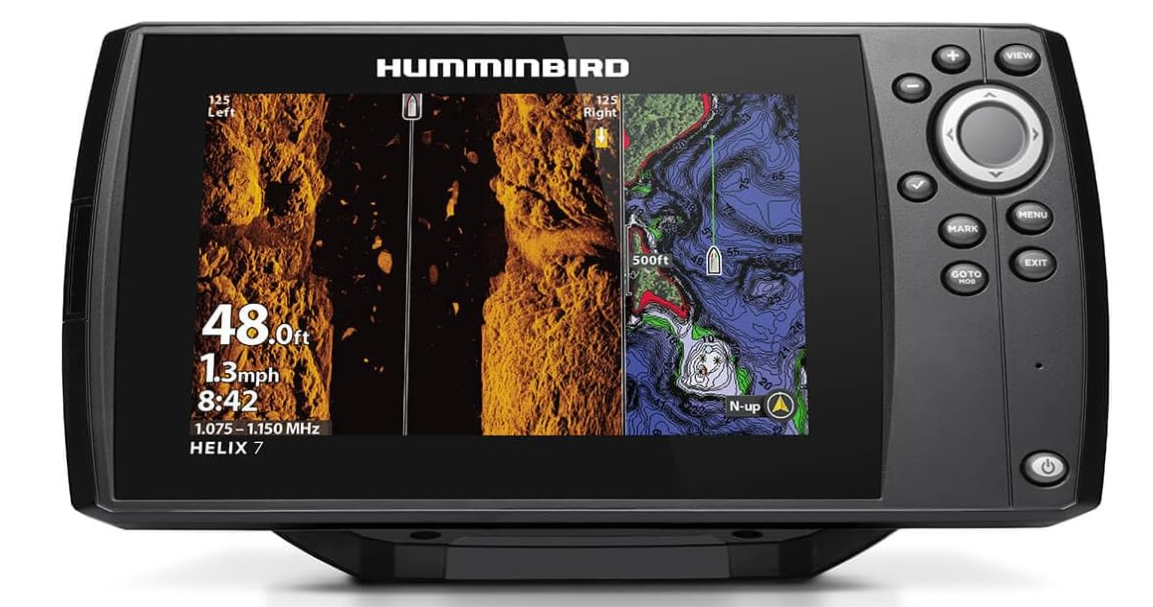
1)Humminbird HELIX 7 G4 GPS Fish Finder
Get it on Amazon
The Humminbird HELIX 7 G4 GPS Fish Finder is designed for anglers who want detailed underwater imaging, reliable fish detection, and convenient GPS navigation in one unit. Its MEGA Side Imaging and Down Imaging technology provides detailed views of fish, underwater structures, and bottom contours, while Dual Spectrum CHIRP sonar helps identify fish and locate productive fishing areas. The included Humminbird Basemap offers coverage of more than 10,000 lakes and continental U.S. coastlines, making navigation easier in familiar and unfamiliar waters. With AutoChart Live mapping, anglers can create their own maps while boating, recording depth contours, bottom hardness, and vegetation. Its intuitive keypad controls also make it practical to operate in different weather conditions.
Pros
• Detailed MEGA Imaging: Provides views of fish, underwater structures, and contours up to 125 feet on either side of the boat and 125 feet directly below, with three times more detail than standard imaging sonar.
• Dual Spectrum CHIRP Sonar: Offers Wide Mode for broader coverage and Narrow Mode for more detailed scanning, helping anglers locate fish and identify underwater structures.
• Accurate Target Separation: The Low-Q transducer supports precise separation of individual sonar targets, making it easier to distinguish fish that are close together.
• Extensive GPS Mapping: Humminbird Basemap includes coverage of more than 10,000 lakes and continental U.S. coastlines for convenient navigation.
• Custom Mapping Capabilities: AutoChart Live records depth contours, bottom hardness, and vegetation, allowing anglers to develop detailed maps of their favorite fishing locations.
• Expandable Chart Compatibility: Supports premium LakeMaster, CoastMaster, and Navionics charts for anglers who need additional mapping options.
• Included Transducer: The transducer comes with the unit, providing the essential sonar component needed for its imaging and fish detection capabilities.
• Simple Keypad Operation: The softkey interface and preloaded views make it easier to access sonar information and navigation settings in varying weather conditions.
Cons
• Limited Built In Mapping Time: AutoChart Live provides eight hours of recording time, which may be restrictive for anglers who regularly explore new fishing locations.
2)Humminbird 411670-1 Helix 5 Chirp
Get it on Amazon
The Humminbird 411670-1 HELIX 5 CHIRP Fish Finder is designed for anglers who want dependable fish detection and GPS navigation in a compact unit. Its CHIRP Down Imaging technology filters out visual noise and clutter to provide a clearer view beneath the boat, while CHIRP Digital Sonar processing helps anglers identify fish and underwater structures. Dual Spectrum CHIRP sonar offers Wide Mode for broader coverage and Narrow Mode for more detailed scanning, helping users adapt their search to different fishing conditions. The built in Humminbird Basemap provides coverage of more than 10,000 lakes and continental U.S. coastlines, with compatibility for additional LakeMaster, CoastMaster, and Navionics charts. AutoChart Live allows anglers to create maps of depth contours, bottom hardness, and vegetation, while the intuitive keypad makes it straightforward to access sonar views and navigation settings. These features make the HELIX 5 a useful option for anglers looking for fish finding and GPS mapping capabilities in one device.
Pros
• Clear CHIRP Down Imaging: Filters visual noise and clutter to provide a clearer view of underwater surroundings, making it easier to examine areas beneath the boat.
• Detailed Fish Detection: CHIRP Digital Sonar processing helps anglers identify fish and locate structures where fish may gather.
• Dual Spectrum CHIRP Sonar: Wide Mode offers maximum search coverage, while Narrow Mode provides more detailed scanning for examining promising fishing areas.
• Precise Target Separation: The Low Q transducer supports accurate separation of sonar targets, helping distinguish individual fish and nearby objects.
• Built In GPS Mapping: Humminbird Basemap covers more than 10,000 lakes and continental U.S. coastlines, supporting navigation and location awareness.
• Compatible With Premium Charts: Support for LakeMaster, CoastMaster, and Navionics charts gives anglers additional mapping options.
• Custom Underwater Mapping: AutoChart Live creates maps showing depth contours, bottom hardness, and vegetation while the boat is moving.
• Convenient Keypad Controls: The softkey interface provides access to preloaded sonar views and settings, allowing operation in different weather conditions.
Cons
• Limited Built In Recording Time: AutoChart Live includes eight hours of recording time, which may be restrictive for anglers mapping numerous fishing locations.
3)Humminbird XPLORE Series Fish Finder
The Humminbird XPLORE Series Fish Finder is designed for anglers who want advanced sonar imaging, detailed GPS navigation, and convenient control over their fishing electronics. Its MEGA Side Imaging+ technology provides a viewing range of up to 200 feet on each side of the boat, while MEGA Down Imaging+ offers coverage to depths of 200 feet. Dual Spectrum CHIRP sonar helps identify fish and underwater structures, giving anglers more information when searching for productive fishing locations. The built in GPS works with enhanced Humminbird Basemap, which covers more than 10,000 lakes and coastal waters and includes details such as terrain, markers, hazards, and marina locations. The system also includes a LakeMaster and CoastMaster VX map card for regions in the United States and Canada. AutoChart Live creates real time maps of depth contours, bottom hardness, and vegetation, while the 10 inch touchscreen and keypad provide flexible control. Bluetooth connectivity, Ethernet, NMEA 2000 networking, and compatibility with Minn Kota trolling motors and Cannon products make the XPLORE Series suitable for anglers building a connected boat electronics system. However, this is a control head only model, meaning a transducer is not included.
Pros
• Advanced MEGA Side Imaging+: Provides imaging coverage up to 200 feet on each side of the boat, helping anglers examine underwater structures and search wider areas.
• Detailed MEGA Down Imaging+: Offers coverage to depths of 200 feet, allowing anglers to inspect underwater terrain and identify potential fish holding areas.
• Dual Spectrum CHIRP Sonar: Supports fish detection and clearer views of underwater structures, helping anglers evaluate promising fishing spots.
• Comprehensive GPS Navigation: Humminbird Basemap covers more than 10,000 lakes and coastal waters, with terrain details, markers, hazards, and marina locations.
• Included Premium Mapping Card: The LakeMaster and CoastMaster VX map card provides additional mapping resources for supported regions in the United States and Canada.
• Real Time Mapping Capabilities: AutoChart Live creates maps of depth contours, bottom hardness, and vegetation, helping anglers understand fishing locations more thoroughly.
• Flexible Touchscreen and Keypad Controls: The 10 inch interface offers two control methods, allowing anglers to navigate settings and sonar displays according to their preferences.
• Advanced Connectivity: Bluetooth, high speed Ethernet, and built in NMEA 2000 networking support connections with compatible electronics, while One Boat Network integration allows compatibility with Minn Kota trolling motors and Cannon products.
Cons
• Transducer Not Included: The control head only configuration does not include a transducer, so buyers need to account for the cost of obtaining a compatible unit.
4)Humminbird Helix 7 G4N GPS Fish Finder
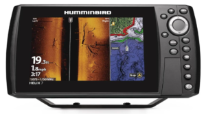
The Humminbird HELIX 7 G4N GPS Fish Finder is designed for anglers who want detailed sonar imaging, dependable GPS navigation, and connectivity with compatible marine electronics. Its MEGA Side Imaging and Down Imaging technology provides views of fish, underwater structures, and bottom contours up to 125 feet on either side of the boat and 125 feet directly beneath it, delivering three times more detail than standard imaging sonar. The included transducer supports the unit’s sonar capabilities, while Dual Spectrum CHIRP sonar offers Wide Mode for maximum coverage and Narrow Mode for detailed scanning. Its built in Humminbird Basemap covers more than 10,000 lakes and continental U.S. coastlines, with compatibility for premium LakeMaster, CoastMaster, and Navionics charts. AutoChart Live allows anglers to create real time maps of depth contours, bottom hardness, and vegetation, with eight hours of built in recording time. Ethernet ports, Bluetooth, and built in NMEA 2000 networking provide additional connectivity, while integration with compatible Minn Kota trolling motors and Cannon products makes this fish finder a practical choice for anglers looking to expand their boat electronics system.
Pros
• Detailed MEGA Imaging: MEGA Side Imaging and Down Imaging provide views up to 125 feet on either side of the boat and 125 feet below, with three times more detail than standard imaging sonar.
• Included Transducer: The transducer comes with the unit, allowing anglers to use its supported sonar functions without having to source this essential component separately.
• Dual Spectrum CHIRP Sonar: Wide Mode offers broader search coverage, while Narrow Mode provides detailed scanning of fish and underwater structures.
• Precise Target Separation: The Low Q transducer supports accurate 2D target separation, helping anglers distinguish fish and identify potential fishing areas.
• Extensive GPS Mapping: Humminbird Basemap includes coverage of more than 10,000 lakes and continental U.S. coastlines for navigation and location awareness.
• Premium Chart Compatibility: Support for LakeMaster, CoastMaster, and Navionics charts provides options for anglers who need additional mapping detail.
• Custom Underwater Mapping: AutoChart Live records depth contours, bottom hardness, and vegetation, helping anglers create useful maps of their preferred fishing locations.
• Advanced Connectivity: Ethernet, Bluetooth, and built in NMEA 2000 networking support connections with compatible marine electronics, including integration with Minn Kota and Cannon products.
Cons
• Limited Built In Mapping Time: AutoChart Live provides eight hours of recording time, which may not be sufficient for anglers who frequently explore and map new waters.
5)Garmin ECHOMAP UHD2 53CV Chartplotter/Fishfinder
Get it on Amazon
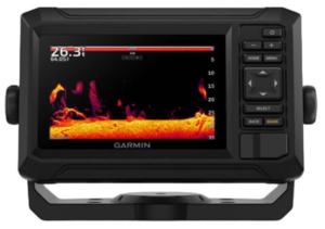
The Garmin ECHOMAP UHD2 53CV Chartplotter/Fishfinder is designed for anglers who want clear sonar imaging, dependable navigation, and convenient mapping in a compact 5 inch display. It combines Garmin CHIRP traditional sonar with ClearVü scanning sonar to provide two different views of the underwater environment, helping anglers locate fish and examine submerged structures. Its high contrast vivid color palettes make it easier to distinguish fish targets and underwater features, while the bright keyed display provides straightforward operation. For navigation, the unit comes with preloaded US inland maps and supports LakeVü g3 inland maps, BlueChart g3 coastal charts, and compatible Garmin Navionics+ and Garmin Navionics Vision+ marine cartography. Built in Wi Fi enables wireless information sharing with compatible ECHOMAP UHD2 chartplotters, including sonar data, waypoints, and routes. The ActiveCaptain app adds access to OneChart, software updates, and Garmin Quickdraw Community data. Supplied with a GT20 TM transducer, power and data cable, mounting options, hardware, and documentation, this model offers a practical combination of fish finding and GPS navigation for anglers who prefer a smaller, feature rich chartplotter.
Pros
• Dual Sonar Technology: Garmin CHIRP traditional sonar and ClearVü scanning sonar provide two complementary views to help anglers locate fish and examine underwater structures.
• Clear Underwater Imaging: High contrast vivid color palettes make it easier to distinguish fish targets, submerged objects, and underwater structures.
• Compact Keyed Display: The bright 5 inch screen and physical buttons provide convenient access to sonar and navigation functions.
• Preloaded Inland Maps: Included US inland maps and support for LakeVü g3 help anglers navigate mapped inland waters.
• Coastal Chart Compatibility: Support for BlueChart g3, Garmin Navionics+, and Garmin Navionics Vision+ provides additional mapping options for compatible marine charts.
• Wireless Data Sharing: Built in Wi Fi allows compatible ECHOMAP UHD2 5 inch and 7 inch chartplotters to share information such as sonar data, waypoints, and routes.
• ActiveCaptain App Support: The compatible smartphone app provides access to OneChart, software updates, Garmin Quickdraw Community data, and other connected features.
• Useful Included Accessories: The package includes a GT20 TM transducer, power and data cable, tilt mount, flush mount, mounting hardware, and documentation.
Cons
• Small Screen Size: The 5 inch display may feel cramped when viewing detailed sonar images and navigation charts simultaneously, especially compared with larger chartplotters.
6)Garmin ECHOMAP UHD2 54CV Chartplotter/Fishfinder
Get it on Amazon
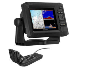
The Garmin ECHOMAP UHD2 54CV Chartplotter/Fishfinder is designed for anglers who want reliable fish detection, clear underwater imaging, and convenient GPS navigation in a compact unit. Its bright 5 inch keyed display provides straightforward operation, making it easier to access sonar views and navigation information while on the water. Garmin CHIRP traditional sonar and ClearVü scanning sonar offer two complementary views of the underwater environment, helping anglers locate fish and examine submerged structures. High contrast vivid color palettes improve the visibility of fish targets and underwater features, allowing users to interpret sonar images more easily. The built in Wi Fi connectivity also supports information sharing between compatible chartplotters, helping anglers transfer useful data between devices. With support for LakeVü g3 inland maps and BlueChart maps incorporating Navionics data, the ECHOMAP UHD2 54CV offers useful mapping options for navigating suitable fishing waters. Its combination of sonar technology, chartplotting capabilities, and convenient physical controls makes it a practical option for anglers looking for a compact fish finder and GPS system.
Pros
• Dual Sonar Technology: Garmin CHIRP traditional sonar and ClearVü scanning sonar provide complementary underwater views to help anglers locate fish and identify submerged structures.
• Bright Keyed Display: The 5 inch screen and physical buttons offer convenient access to sonar settings and navigation functions.
• High Contrast Color Palettes: Vivid colors help distinguish fish targets and underwater structures, making sonar images easier to interpret.
• Wireless Connectivity: Built in Wi Fi allows compatible chartplotters to share information, providing greater convenience for anglers using multiple devices.
• Inland Mapping Support: Compatibility with LakeVü g3 maps helps anglers navigate supported inland lakes and locate fishing areas.
• Coastal Chart Compatibility: BlueChart maps incorporating Navionics data provide additional navigation options for supported coastal waters.
• Compact Design: The 5 inch display offers a space conscious option for boats where a larger chartplotter may be difficult to accommodate.
• Useful Combined Functions: The combination of fish finding sonar, chartplotting, and GPS navigation helps anglers manage fishing and navigation information from one device.
Cons
• Small Display: The 5 inch screen may feel restrictive when viewing detailed sonar images and navigation charts, particularly when compared with larger models.
You may also like to read Best Budget Fish Finder with Side Imaging
Best Fish Finder and GPS with Side Imaging Advantages
1. Wider Underwater Coverage
Side imaging technology allows anglers to examine large areas beneath the water and on either side of their boats. This wider viewing range makes it easier to locate fish, submerged structures, underwater vegetation, and potential fishing spots without relying entirely on traditional sonar directly beneath the boat.
2. Improved Fish Detection
Advanced sonar technologies, including CHIRP sonar, help anglers identify fish targets and distinguish them from underwater structures. Better target separation can make it easier to recognize fish arches and determine where fish may be gathering, improving the efficiency of each fishing trip.
3. Detailed Underwater Imaging
High resolution sonar imaging provides clearer views of underwater terrain, submerged objects, and changes in bottom structure. These details help anglers understand the environment beneath their boats and identify areas that may attract fish, including drop offs, rocks, and vegetation.
4. Accurate GPS Navigation
Built in GPS helps anglers mark productive fishing locations, follow routes, and return to previously discovered spots. This is particularly useful when fishing unfamiliar waters or revisiting locations where successful catches have occurred, reducing dependence on memory alone.
5. Advanced Mapping Capabilities
Many modern fish finders support detailed lake charts and custom mapping tools that record depth contours, bottom hardness, and vegetation. These features help anglers understand underwater geography, identify promising fishing zones, and develop a more informed approach to locating fish.
6. Easier Identification of Fishing Structures
Combining side imaging, down imaging, and traditional sonar allows anglers to examine underwater environments from different perspectives. This makes it easier to identify submerged timber, rocky areas, vegetation beds, and other structures that may provide shelter or feeding opportunities for fish.
7. Convenient Operation and Connectivity
Modern fish finders often feature intuitive keypad or touchscreen controls, along with wireless connectivity and support for compatible marine electronics. These conveniences make it easier to manage sonar settings, share navigation information, and integrate the device with other equipment on the boat.
8. Greater Fishing Efficiency
Combining fish detection, side imaging, and GPS navigation in one system helps anglers spend less time searching unproductive areas. By identifying promising structures, recording successful locations, and navigating more efficiently, anglers can make better use of their time on the water and improve their overall fishing experience.
Factors to Consider When Choosing the Best Fish Finder and GPS with Side Imaging
1. Sonar Technology and Imaging Quality
Consider the sonar technologies available and the clarity of the underwater images they produce. Side imaging scans areas on either side of your boat, while down imaging provides views directly beneath it. CHIRP sonar helps identify fish and separate targets from underwater structures. Choosing a fish finder with clear, detailed imaging makes it easier to locate fish, examine submerged objects, and identify potentially productive fishing areas.
2. Side Imaging Range and Depth Coverage
Evaluate the distance the device can scan on either side of the boat and its depth coverage. A wider side imaging range helps you examine larger areas without moving the boat as frequently, while adequate depth coverage is important for fishing in deeper waters. Consider your usual fishing environment, whether it involves shallow lakes, rivers, or deep coastal waters, to determine the range that best suits your needs.
3. GPS Accuracy and Navigation Features
Reliable GPS navigation helps you mark productive fishing spots, save waypoints, plan routes, and return to previously discovered locations. Look for useful navigation features such as route recording, position tracking, and hazard marking. These capabilities are especially valuable when exploring unfamiliar waters, allowing you to navigate more confidently and spend less time searching for locations you have already identified.
4. Mapping Coverage and Chart Compatibility
Check the mapping coverage included with the fish finder and whether it supports additional charts. Some systems provide detailed inland lake maps, while others offer coastal charts and advanced mapping options. Custom mapping features can help you record depth contours, bottom hardness, and underwater vegetation. Before purchasing, confirm that compatible charts cover your intended fishing locations, particularly if you fish outside the United States and Canada.
5. Display Size and Ease of Operation
Choose a display that allows you to view sonar images, navigation charts, and depth readings comfortably. Smaller screens are suitable for boats with limited mounting space, while larger displays make detailed images easier to interpret. Consider brightness, sunlight readability, keypad or touchscreen controls, and menu simplicity. An intuitive interface helps you adjust settings and monitor underwater conditions without unnecessary distractions while fishing.
6. Transducer Quality and Compatibility
The transducer determines which sonar technologies the fish finder can use, so it is important to check its capabilities and compatibility. Confirm whether the package includes a transducer and whether it supports the required side imaging, down imaging, and traditional sonar functions. If it is sold separately, account for the additional expense and installation requirements. Choosing a suitable transducer ensures that the system can deliver the imaging performance you expect.
7. Connectivity and Compatibility with Other Equipment
Consider whether the fish finder supports Wi Fi, Bluetooth, Ethernet, or NMEA 2000 networking. Depending on the model, these connections can enable data sharing between compatible chartplotters and integration with trolling motors or other marine electronics. Expandable connectivity is particularly useful if you plan to build a more advanced boat electronics system over time. Always verify compatibility before purchasing additional equipment.
8. Price, Accessories, and Long Term Value
Compare the purchase price with the features, accessories, and mapping options included. Additional expenses may include transducers, premium charts, mapping memory cards, installation materials, and compatible marine electronics. Consider how frequently you fish, the type of water you explore, and which features you will actually use. The best value comes from choosing a dependable system that meets your fishing and navigation requirements without paying for unnecessary capabilities.
Best Fish Finder and GPS with Side Imaging FAQs
1. What is the best fish finder and GPS with side imaging?
The best fish finder and GPS with side imaging depends on your fishing needs, budget, and preferred water conditions. Look for a model that offers clear side imaging, reliable GPS navigation, detailed sonar technology, and compatible mapping charts. A unit with down imaging, CHIRP sonar, and waypoint marking can provide additional benefits when locating fish and returning to productive fishing spots.
2. Is side imaging better than traditional fish finder sonar?
Side imaging and traditional sonar serve different purposes. Side imaging scans areas on either side of the boat, helping anglers locate fish and underwater structures across a wider area. Traditional sonar focuses on detecting fish and objects beneath the boat, while CHIRP technology can improve target separation. Using these technologies together provides a more complete picture of the underwater environment.
3. Do fish finders with GPS and side imaging require additional accessories?
Some models include a compatible transducer, mounting hardware, and preloaded maps, while others are sold as control head units without a transducer. Depending on the model, you may also need to purchase additional charts, mapping memory cards, or compatible networking accessories. Always check the package contents and confirm that suitable maps are available for your fishing location before buying.
The best fish finder and GPS with side imaging combines clear underwater imaging, reliable fish detection, accurate navigation, and detailed mapping to help anglers make the most of their time on the water. Models differ in their sonar capabilities, imaging range, display size, chart compatibility, and connectivity, making it important to choose one that suits your fishing environment and budget. Advanced systems offer wider side imaging coverage, sophisticated mapping, and integration with other marine electronics, while more compact options provide essential fish finding and GPS features for anglers who prefer a straightforward setup. Features such as CHIRP sonar, down imaging, waypoint marking, and custom depth mapping can further improve the fishing experience. Ultimately, what distinguishes the best option is how effectively it combines these capabilities, offers ease of use, and meets your individual needs without unnecessary expense.
Conclusion
The best fish finder and GPS with side imaging combines clear underwater imaging, reliable fish detection, accurate navigation, and detailed mapping to help anglers make the most of their time on the water. Models differ in their sonar capabilities, imaging range, display size, chart compatibility, and connectivity, making it important to choose one that suits your fishing environment and budget.
Advanced systems offer wider side imaging coverage, sophisticated mapping, and integration with other marine electronics, while more compact options provide essential fish finding and GPS features for anglers who prefer a straightforward setup. Features such as CHIRP sonar, down imaging, waypoint marking, and custom depth mapping can further improve the fishing experience. Ultimately, what distinguishes the best option is how effectively it combines these capabilities, offers ease of use, and meets your individual needs without unnecessary expense.